
District Overview
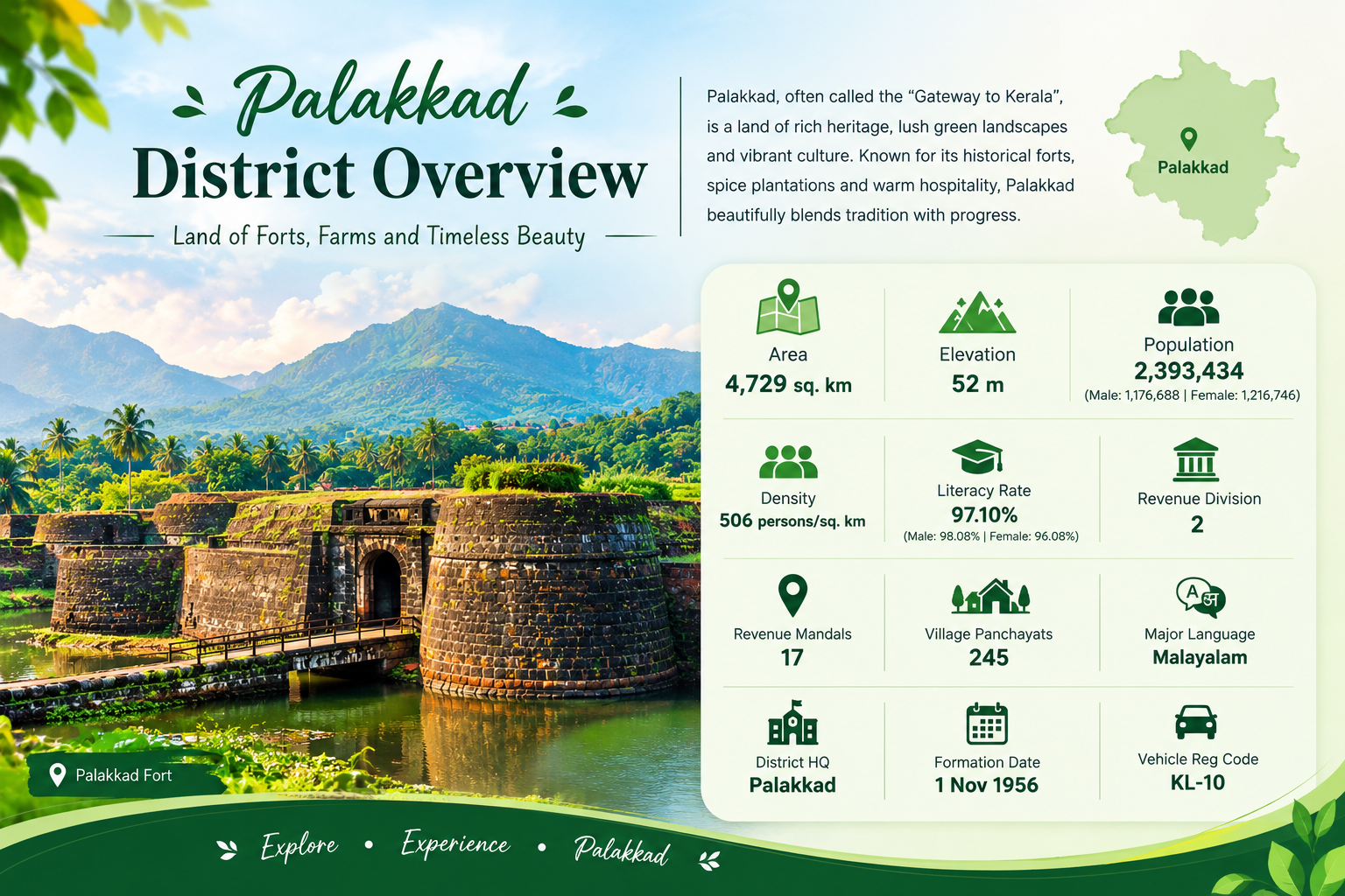
Palakkad, often called the “Gateway to Kerala,” is a beautiful district known for its rich heritage, lush green landscapes, historic forts, agriculture, and vibrant culture. Surrounded by the Western Ghats, Palakkad offers a unique blend of natural beauty, traditional lifestyle, historical landmarks, and modern development.
- Area: 4,482 sq. km
- District Headquarters: Palakkad
- Major Language: Malayalam
- Famous Landmark: Palakkad Fort
- Known For: Agriculture, paddy fields, forts, temples, forests, and scenic landscapes
- Geographical Importance: Palakkad Gap provides an important natural passage through the Western Ghats Palakkad, one of Kerala’s fourteen districts, is a land of scenic landscapes, rich cultural heritage, agriculture, and historic landmarks. Often described as the gateway to Kerala, the district is connected to the rest of the country through the Palakkad Gap, a natural pass through the Western Ghats.
Total Towns information
| S.No. | Town / Urban Centre | Type |
|---|---|---|
| 1 | Palakkad | Municipality |
| 2 | Chittur-Thathamangalam | Municipality |
| 3 | Mannarkkad | Municipality |
| 4 | Cherpulassery | Municipality |
| 5 | Ottappalam | Municipality |
| 6 | Shoranur | Municipality |
| 7 | Pattambi | Municipality |
Population details
| S.No. | Population Category | Population / Details |
|---|---|---|
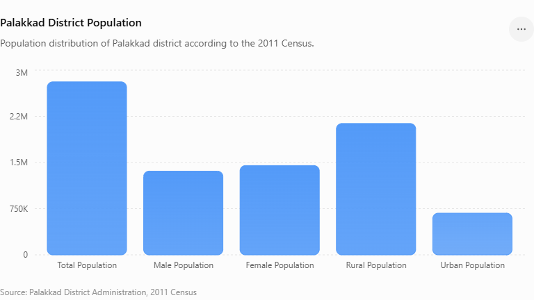
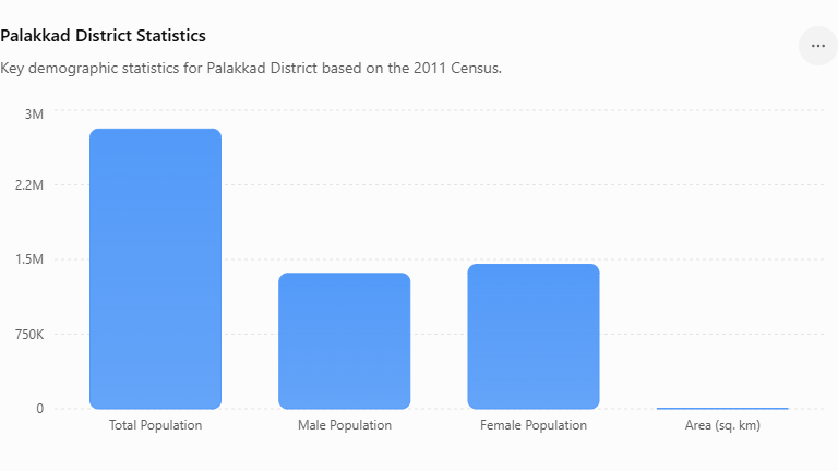
| 1 | Total Population | 2,809,934 |
| 2 | Male Population | 1,359,478 |
| 3 | Female Population | 1,450,456 |
| 4 | Rural Population | 2,133,124 |
| 5 | Urban Population | 676,810 |
| 6 | Rural Male Population | 1,031,466 |
| 7 | Rural Female Population | 1,101,658 |
| 8 | Urban Male Population | 328,012 |
| 9 | Urban Female Population | 348,798 |
| 10 | Sex Ratio | 1,067 females per 1,000 males |
| 11 | Population Density | 627 persons/sq. km |
| 12 | Decadal Growth (2001–2011) | 7.35% |
| 13 | Overall Literacy Rate | 89.31% |
| 14 | Male Literacy Rate | 93.10% |
| 15 | Female Literacy Rate | 85.79% |
| 16 | Scheduled Caste Population | 14.37% |
| 17 | Scheduled Tribe Population | 1.74% |
Population Chart
Measurements data
| Measurement | Palakkad District |
|---|---|
| Area | 4,482 sq. km |
| North–South extent | Approximately 75 km |
| East–West extent | Approximately 60 km |
| Average Elevation | Around 84 m above sea level |
| Highest Point | Dhoni Hills / Western Ghats region |
| Major Mountain Range | Western Ghats |
| Major Pass | Palakkad Gap |
| District Headquarters | Palakkad |
Statistics information
Previous History content of the district
Palakkad has a long and fascinating history shaped by its strategic location at the Palakkad Gap, a natural passage through the Western Ghats. The early history of the region is not fully documented, but historical accounts suggest that the area may have been associated with the Pallava dynasty of Kanchi during the early centuries AD. The region was later ruled by the Perumals and, after their period of rule, came under several local chieftains, including the rulers of Valluvanad, Vengunad and Palakkad.
During the 18th century, Palakkad became an important centre in the political struggles of southern India. In 1757, the Zamorin of Calicut invaded Palakkad, and the Raja of Palakkad sought assistance from Hyder Ali of Mysore. Hyder Ali’s intervention forced the Zamorin to retreat. Subsequently, Hyder Ali brought the Palakkad region under Mysore control, and the area was later ruled by his son, Tipu Sultan.
The conflicts between Tipu Sultan and the British East India Company eventually resulted in the transfer of Mysore’s possessions in Malabar to the British. Palakkad subsequently became part of the Malabar District under the Madras Presidency.
The modern administrative history of Palakkad began on 1 January 1957, when Palakkad District was formed with Palakkad, Perinthalmanna, Ponnani, Ottapalam, Alathur and Chittur taluks. Later administrative changes followed, particularly after the formation of Malappuram District in 1969. Several areas were transferred between districts, and Mannarkkad became a separate taluk.
In 2013, Ottapalam taluk was divided and Pattambi taluk was formed. Over the years, Palakkad has continued to develop as an important agricultural, cultural, educational and industrial centre of Kerala.
Today, Palakkad is known for its rich historical heritage, Palakkad Fort, traditional cultural practices, agricultural landscapes and its important geographical position as the gateway between Kerala and the neighbouring regions of Tamil Nadu and the rest of India.